
6 in 10 Urban Residents in Spain Lack Nearby Green Space, Study Finds, Renewing Focus on Urban Heat and Health
A new study by Amigas de la Tierra and the Polytechnic University of Madrid reveals that 60% of residents in 10 Spanish cities live more than 300 meters from a quality green space, with major implications for urban heat management and public health.
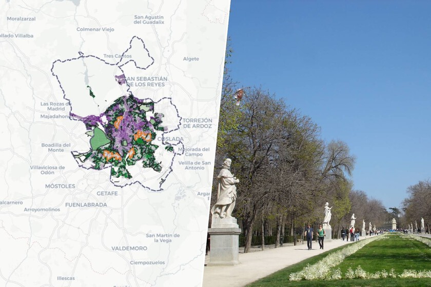
A new cartographic study from the environmental group Amigas de la Tierra and the Polytechnic University of Madrid (UPM) has quantified a stark gap in urban green space access across Spain: 6 out of 10 residents in 10 analyzed cities live more than 300 meters from a quality green zone. The findings, released in late July 2026, directly connect urban planning deficits to rising heat waves and public health outcomes, a topic increasingly relevant as cities look to AI-driven climate adaptation tools.
Key facts
| Metric | Value |
|---|---|
| Population in deficit of green space (300m radius) | 60% across 10 cities |
| Valencia residents without nearby quality green space | 80% |
| Madrid residents living far from good green zones | Nearly 2 million |
| Cities with best access | Valladolid, Santiago de Compostela |
The study analyzed Madrid, Valencia, Seville, Zaragoza, Palma, Valladolid, Badajoz, Ourense, Ibiza, and Santiago de Compostela. Researchers combined municipal urban planning cartography, orthophotos, and OpenStreetMap data to identify public green spaces larger than one hectare. They then cross-referenced this with average income per census section to examine socioeconomic disparities. Valencia recorded the worst ratio, with 80% of its citizens living more than 300 meters from a quality green space. In Madrid, nearly two million people are in a green space deficit, with a pronounced contrast between wealthy and poorer neighborhoods. Badajoz, despite having nearly 25 square meters of green space per inhabitant, sees 70% of its population living far from those zones, revealing poor distribution.
The 3-30-30 rule and public health
The research is framed around the 3-30-300 rule, a guideline popularized by urban forestry scientist Cecil Konijnendijk. It recommends that every resident should see at least three trees from their home, have 30% tree canopy cover in their neighborhood, and be within 300 meters of a park. The World Health Organization (WHO) has previously endorsed the 300-meter standard. Epidemiological studies cited in the research link proximity to green space with lower rates of childhood mental and behavioral disorders in Spain, reduced physical inactivity in the Netherlands, and lower cardiovascular risk in Lithuania. The rule has been adopted as a planning standard by several cities in Europe, the United States, and Canada.
Why this matters for AI and urban tech readers
For a site focused on AI tools and urban tech, this study provides a real-world dataset that could train or validate AI models for urban heat island mitigation, green space allocation, and climate resilience planning. The methodology—combining municipal GIS data, satellite imagery, and open mapping data—is a common pipeline for machine learning projects in smart city initiatives. Tools that can simulate tree canopy coverage, model pedestrian cooling benefits, or prioritize neighborhood interventions based on income and health data are directly relevant to developers and planners. The study also highlights a data gap: it excludes private green spaces like gardens and pools, which distorts results in cities like Ibiza where wealthier neighborhoods have private greenery not captured by public mapping. This limitation is a practical caveat for anyone building urban analytics tools.
Limits and next checks
The study only maps public green spaces, meaning private gardens, courtyards, and pools are not included. The authors note that, unlike in some other countries, the correlation between green space access and income in Spain is not always linear. In Ibiza, for example, public data shows worse access in richer neighborhoods, likely because those residents rely on private spaces. The dataset is available for further analysis, and the methodology is reproducible for other cities. For developers and researchers, the next step would be to integrate private land-use data or satellite-derived NDVI (Normalized Difference Vegetation Index) to create a more complete picture.
Source: Xataka IA (translated and adapted) — “Si los árboles son el arma contra el calor, España va perdiendo: 6 de cada 10 personas no tienen un parque cerca” — https://www.xataka.com/ecologia-y-naturaleza/arboles-arma-calor-espana-va-perdiendo-6-cada-10-personas-no-tienen-parque-cerca
Source
Xataka IA Publicacion original: 2026-08-01T18:01:43+00:00
Related articles
OCU Finds Spanish Homeowner Communities Overpaying Up to €1,500 on Electricity and €3,515 on Gas—Can AI Tools Optimize Shared Energy Bills?
A new OCU analysis of Spanish homeowner community bills reveals widespread overpayment due to non-competitive tariffs and excess contracted power. Could AI-driven…
Read article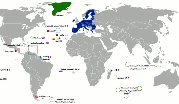
Mayotte fiber dispute does not meet ReviewArticle’s AI news brief
Le Monde reports that France’s competition authority has ordered Orange to suspend part of its fiber-optic rollout in Mayotte. The dispute is…
Read article
DiffEEG Model Uses Diffusion Pre-Training to Improve Seizure Detection from Minimal Labeled Data
Researchers have introduced DiffEEG, a 9.6-million-parameter foundation model that combines denoising diffusion pre-training with reinforcement learning fine-tuning to detect seizure events from…
Read article
The Technology Trap: Why AI Cannot Escape the Unchanging Fundamentals of War
A new Foreign Affairs essay by former Pentagon official Mara Karlin warns that over-reliance on AI and advanced tech in military planning…
Read articleWiki relacionada

AI Model API Pricing and Context Window Comparison: Current Rates and Limits
Compare the latest API pricing, context windows, and capabilities of leading AI model providers including OpenAI, Anthropic, Google, and Mistral. Practical guidance…
Read article
AI Agent Evaluation Frameworks: How to Benchmark Agentic Systems
A practical guide to evaluating AI agents — from task completion metrics to safety, cost, and robustness. Covers major frameworks, primary sources,…
Read article
LLM Benchmarks Decoded: What MMLU, HumanEval, and GSM8K Actually Measure for Developers
A developer-focused breakdown of the most-cited LLM benchmarks — MMLU, HumanEval, GSM8K, MATH, Chatbot Arena — including what they test, their hidden…
Read article
What Is RAG? A Practical Guide to Retrieval-Augmented Generation in 2025
Retrieval-Augmented Generation (RAG) grounds LLM outputs in external data, reducing hallucinations and enabling enterprise use cases. This guide covers how RAG works,…
Read article